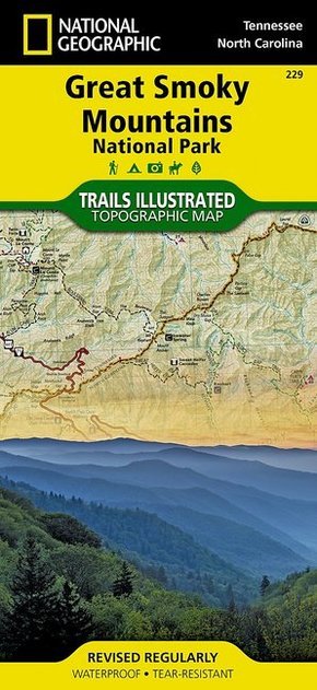
National Geographic Trails Illustrated Map Great Smoky Mountains National Park, Tennessee / North Carolina, USA - Outdoor Recreation Map. Appalachian Trail, Benton MacKaye Trail, Mountains-to-Sea Trail, Backcountry Campsites, Stream Crossing Charts, Trail Mileages
Reduzierte Artikel in dieser Kategorie

Preisbindung aufgehoben3
2,99 €6,99 €3
2,99 €
Preisbindung aufgehoben3
4,99 €30,00 €3
4,99 €
Produktdetails
| Verlag | National Geographic Maps |
| Auflage | 2012 |
| Format | 10,7 x 22,9 x 0,5 cm |
| Polychrome print. Folded | |
| Gewicht | 96 g |
| Artikeltyp | Karte |
| Reihe | National Geographic Trails Illustrated Map |
| ISBN-10 | 1566953014 |
| EAN | 9781566953016 |
| Bestell-Nr | 56695301UA |
Produktbeschreibung
America's most visited national park straddles Tennessee and North Carolina with its seemingly endless forest. The map includes the park in its entirety; the Appalachian Trail; Twentymile Trail; Lakeshore Trail; Chasteen Creek Trail; the Great Smoky Mountains; Chilowee Mountain; Little Mountain; the Blue Ridge Parkway; Cataloochee Divide; Cherokee National Forest; Nantahala National Forest; Little Tennessee River; Chilhowee Lake; Fontana Lake; the cities of Maryville and Gatlinburg Tennessee, and Waynesville, North Carolina; and more. UTM grids for use with GPS.
Mehr Angebote zum Thema
