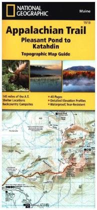
National Geographic Adventure Travel Map Pleasant Pond to Katahdin
Reduzierte Artikel in dieser Kategorie


Produktdetails
| Verlag | National Geographic Society |
| Auflage | 2015 |
| Format | 10,5 x 23,5 x 0,3 cm |
| Polychrome print. Folded | |
| Gewicht | 76 g |
| Artikeltyp | Karte |
| Reihe | National Geographic Adventure Travel Map 1513 |
| ISBN-10 | 1597756504 |
| EAN | 9781597756501 |
| Bestell-Nr | 59775650UA |
Produktbeschreibung
Waterproof, tear-resistant topographic map guide. The Pleasant Pond to Katahdin Topographic Map Guide makes a perfect traveling companion when traversing the northern Maine section of the Appalachian Trail. Each A.T. Topographic Map Guide includes detailed topographic maps at a detail of 1 inch equals 1 mile. Each page is centered on the A.T. and overlaps with the adjacent pages so there is little chance of getting lost. Along the bottom of each page is a trail profile that shows the distance between shelters, camping areas, and trail access points.
Mehr Angebote zum Thema