
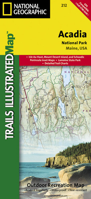
National Geographic Trails Illustrated Map Acadia National Park, Maine, USA - Outdoor Recreation Map. Isle Au Haut, Mount Desert Island, and Schoodic Peninsula Inset Maps, Lamoine State Park, Detailed Trail Charts. 1 : 35.000
Reduzierte Artikel in dieser Kategorie

| Verlag | National Geographic Maps |
| Auflage | 2012 |
| Format | 10,9 x 23,4 x 0,5 cm |
| Polychrome print. Folded | |
| Gewicht | 96 g |
| Artikeltyp | Karte |
| Reihe | National Geographic Trails Illustrated Map 212 |
| ISBN-10 | 1566953529 |
| EAN | 9781566953528 |
| Bestell-Nr | 56695352UA |
Mount Desert Island, Sestern Mountain, Norwood Ridge, Freeman Ridge, Isle au Haut, Marshall Island, Swans Island, Western Bay, Mount Desert Narrows, Eastern May, Frenchman Bay, Eastern Way, Eastern Passage, Long Pond, Seal Cove Pond, Echo Lake, Somes Sound, Upper and Lower Hadlock Pond, Jordan Pond, and Eagle Lake
Klappentext:
This Trails Illustrated topographic map is the most comprehensive recreational map for Acadia National Park, located along the beautiful Atlantic coast in Maine. Updated to reflect road closings, new trails, and campground relocation; it also includes detailed trail information, points of interest, trailheads, picnic areas, facilities, and more. Features sites such as Mount Desert Island, Sestern Mountain, Norwood Ridge, Freeman Ridge, Isle au Haut, Marshall Island, Swans Island, Western Bay, Mount Desert Narrows, Frenchman Bay, Eastern Way, Echo Lake, and more.